
Thinking of Norfolk?
Live Like a Local with Jennifer Dawn

photo credit (norfolk.photodeck.com)
Your Norfolk relocation guide to neighborhoods, schools, commutes, and day-to-day living — designed to help you get oriented before you move.
Salt-air mornings on the Chesapeake and gallery nights in NEON—Norfolk blends waterfront living with a serious arts pulse. This guide puts the city on one page: neighborhoods, commutes, schools, and the day-to-day feel so you can picture life here before you arrive.
This guide is intended for orientation and planning purposes only and does not recommend specific neighborhoods or housing choices.
How to Use This Guide
This Norfolk Area Guide is designed to provide orientation, logistics, and verified resources for those learning about the city. It is not intended to recommend specific neighborhoods or housing choices. For market conditions, buying and selling strategy, or personalized guidance, please refer to the Norfolk Real Estate page or schedule a consultation.
What is “Hampton Roads”? It’s the coastal region anchored by the cities of Norfolk, Virginia Beach, Chesapeake, Portsmouth, Suffolk, Hampton, Newport News, and the Peninsula—one connected economy, shoreline, and lifestyle. Explore by city →
Norfolk, Virginia
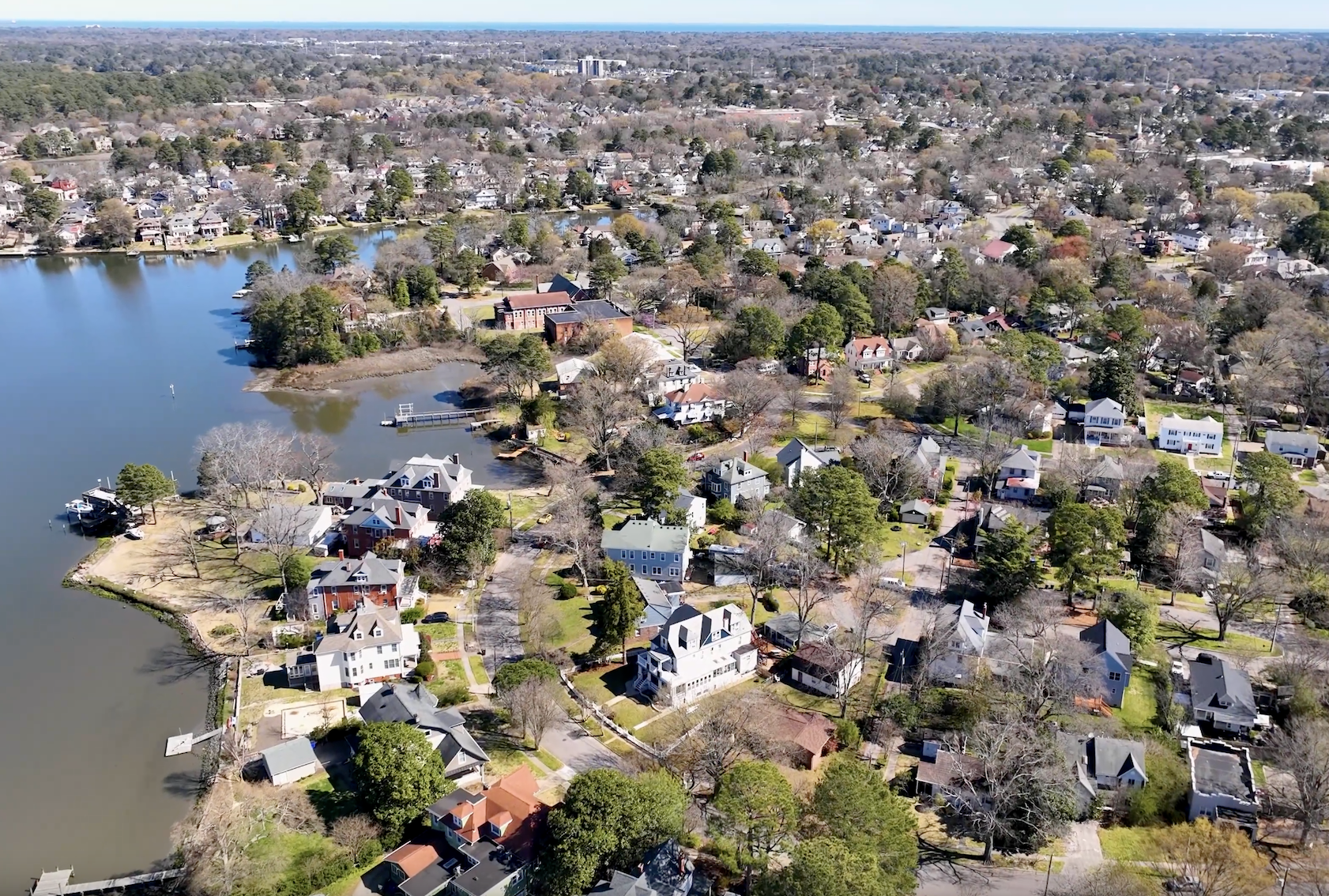
Norfolk sits at the heart of Hampton Roads, shaped by the water that surrounds it and a cultural rhythm that runs from the NEON District’s murals to performances at Chrysler Hall. Neighborhoods range from historic residential areas to bayfront and urban settings across the city.
Military, medical, and university anchors—Naval Station Norfolk, Sentara and EVMS, Old Dominion University, and Norfolk State University—form a strong backbone for daily life, alongside festivals, waterfront trails, gardens, and a dining scene with coastal and international influences.
Norfolk at a Glance
- Population: ~235,000
- Median Household Income: $64,017
- Median Home Value: $319,000
- Median Sale Price: $329,000 (Aug 2025)
- Median List Price: $327,000 (as of Sept 30, 2025)
- Median Days on Market: 23
- Months of Inventory: 2.7
- Sale-to-List Price Ratio: 99%
- Commute: Average ~23 minutes; ~90% commute by car
- Walk & Bike Scores: Walk 45 · Bike 35
- Education Anchors: Norfolk Public Schools; ODU; NSU; EVMS
- Local Highlights: Elizabeth River Trail, Norfolk Botanical Garden, Chrysler Museum & Perry Glass Studio, NEON Arts District, Town Point Park, Ocean View beaches, Colley Avenue dining
- Howard Hanna Community Guide: Norfolk, September 2025 (ACS 2023, Walk Score®, commute & amenities).
- Howard Hanna Market Report: Norfolk, September 2025 (August 2025 sales; Sept 30, 2025 inventory snapshot).
- NAR Realtors Property Resource (RPR), Norfolk, September 2025 (median value and market trend context).
All information is deemed reliable but not guaranteed and is subject to change. Figures are provided for general orientation purposes only and reflect recent aggregated data; they are not intended to predict individual outcomes or market performance. Buyers and sellers should verify details with the appropriate official sources and service providers. MLS data sources may include REIN and other participating MLSs as indicated in the referenced reports; data may not include all available properties. © REIN. Equal Housing Opportunity.
Exploring Norfolk?
Let’s talk about homes that fit your lifestyle and timeline—virtually or in person.
Schedule a Consult
How Norfolk Moves
Norfolk’s transportation mix includes walkable corridors, a regional bus and light-rail network, ferry service across the Elizabeth River, and quick access to regional and national travel by air and rail. Residents commonly commute by car; average travel time is just over twenty minutes, with walk and bike options varying by corridor and neighborhood.
At-a-Glance Mobility Metrics
- Average Commute: ~23 minutes
- Primary Mode: ~90% by car
- Walk Score® (citywide): 45
- Bike Score® (citywide): 35
Citywide metrics provide a broad view; conditions vary by address and time of day.
Driving & Key Corridors
- Highways: I-64, I-264, I-564 connect Norfolk to the region and Naval Station Norfolk.
- Bridges/Tunnels: HRBT (I-64), Midtown & Downtown Tunnels (US-58/I-264).
- Parking: City garages and on-street meters Downtown/Freemason; residential permit zones in select neighborhoods.
Light Rail, Bus & Ferry
- The Tide (Light Rail): Downtown to EVMS/Fort Norfolk with key stations including Harbor Park and Monticello Ave.
- HRT Bus Network: citywide routes with regional connections; the Elizabeth River Ferry links Downtown Norfolk and Portsmouth.
- Trip Planning: real-time schedules via Hampton Roads Transit.
Air Travel (ORF)
- Norfolk International Airport: ~15–20 minutes from Downtown via Norview Ave/Military Hwy; regional and national service.
Amtrak & Regional Rail
- Amtrak Norfolk Station: service to Richmond, Washington, D.C., and the Northeast Corridor.
Tolls & Tunnels
- Midtown Tunnel (US-58) — tolled, operated by Elizabeth River Crossings.
- Downtown Tunnel (I-264/US-58) — tolled, operated by Elizabeth River Crossings.
- Chesapeake Bay Bridge-Tunnel (US-13) — tolled facility connecting to Virginia’s Eastern Shore.
- How tolls work: rates vary by time of day, vehicle class, and payment method; E-ZPass users typically receive lower rates.
- Plan ahead: check current rates and rules before travel.
Official links: Elizabeth River Tunnels (Midtown & Downtown) · Chesapeake Bay Bridge-Tunnel
Moving to Norfolk?
Let’s find a neighborhood that matches your commute. View the commute resource →
Commute times vary by address, time of day, tunnels/bridges, and base gate traffic. Verify live conditions before travel.
- Howard Hanna Community Guide: Norfolk, Sept 2025 (ACS 2023 commute; Walk/Bike scores).
- City of Norfolk — “Getting Around”; VisitNorfolk — transportation pages.
- Hampton Roads Transit (The Tide, bus & ferry); Norfolk International Airport (ORF); Amtrak.
- Elizabeth River Tunnels (Midtown/Downtown tolls); Chesapeake Bay Bridge-Tunnel (US-13).
Information is place-based and time-sensitive; routes, schedules, and toll rates change. Verify specifics with the official providers linked above.
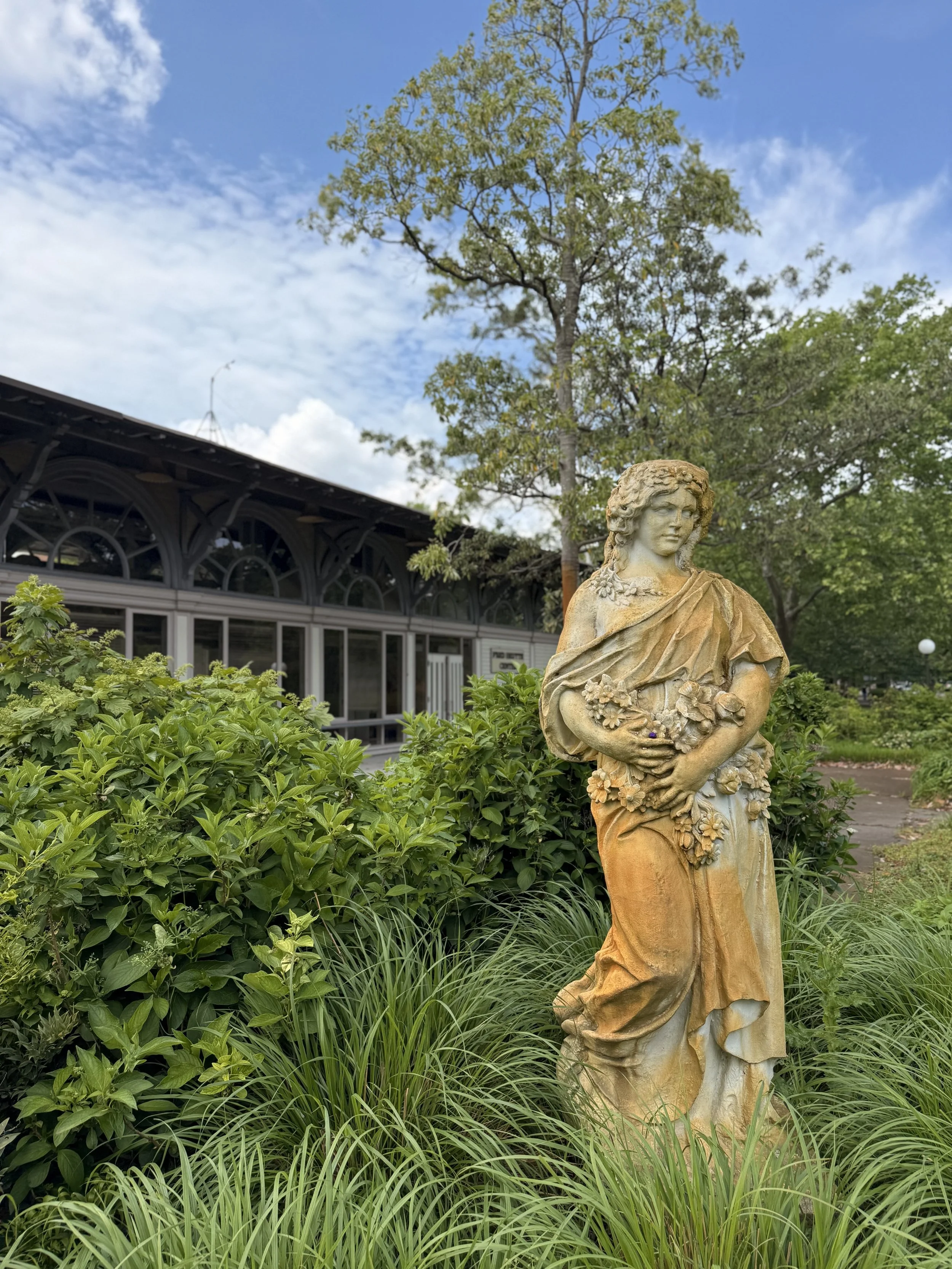
photo credit (jenniferdawnrealestate.com)
What Living in Norfolk Feels Like
Norfolk blends history, waterfront access, and modern culture—from the Cannonball Church to the Elizabeth River Trail’s Glowline, from bayfront sunsets to Broadway tours at Chrysler Hall and nights along Granby Street.
Waterfront & Districts
- Waterside District: riverfront dining/nightlife beside Town Point Park.
- Pagoda & Garden: koi pond, skyline views, seasonal blooms.
- Lambert’s Point: river-view path segments near ODU and the ERT.
- Harbor Park: ballpark on the Elizabeth with Tide light-rail access.
- Half Moone Cruise & Celebration Center: cruise terminal & events.
- City Cruises Norfolk: dinner cruises and harbor tours.
- HeadWaters Resort & Casino (coming soon): planned resort/casino by Harbor Park.
Venues & Performing Arts
- Chrysler Hall: symphony, Broadway, touring performances.
- Scope Arena: concerts, sports, major shows.
- Harrison Opera House: home of the Virginia Opera.
- Wells Theatre (1913): Virginia Stage Company productions.
- Attucks Theatre (1919): historic Black vaudeville theatre, active today.
- MacArthur Center Events: rotating community/seasonal activations.
- Open-Air Venues: Town Point Park, Scope Plaza, Ocean View Beach Park festivals.
- NEON Festival & Pride events: annual downtown celebrations of art and community.
Museums & Landmarks
- MacArthur Memorial (Old City Hall, 1850): museum & research center.
- MacArthur Statue & Memorial Plaza: public plaza and commemorative site.
- Nauticus & Battleship Wisconsin: maritime history and tours.
- Chrysler Museum of Art & Perry Glass Studio.
- Hermitage Museum & Gardens (early 20th c.): riverfront art & historic estate.
- Norfolk Mermaid Trail: public-art mermaids across the city.
- Naval Station Norfolk tours (when available): check official channels for current access.
Historic Faith & Neighborhoods
- St. Paul’s Episcopal (1739): “Cannonball Church” with Revolutionary War history.
- Basilica of St. Mary of the Immaculate Conception (19th c.): Virginia’s only basilica; historic African American parish.
- Christ & St. Luke’s Episcopal (1919): Gothic Revival in Ghent.
- Sacred Heart Catholic (1906): Romanesque landmark in Ghent.
- Freemason Historic District (18th–19th c.): cobblestones and colonial–Victorian architecture.
Gardens
- Norfolk Botanical Garden (est. 1938): 175 acres of themed gardens, seasonal blooms, family areas.
- Hofheimer Camellia Garden: nationally noted camellia collections (within NBG).
- Fred Heutte Garden Center (terminal building 1888): community horticulture hub with classes/events.
- Stockley Gardens Park: Ghent green hosting the biannual Stockley Gardens Art Show.
- Hermitage Gardens: riverside plantings and sculpture gardens.
Parks & Trails
- Elizabeth River Trail (ERT): multi-use waterfront path; don’t miss the Glowline segment at night.
- Town Point Park: Harborfest, Bayou Boogaloo, Wine & Jazz festivals.
- Chelsea Paddle Launch: kayak/SUP access on the Elizabeth.
- Virginia Zoo: family destination with global habitats.
- Cedar Grove Cemetery (1825) & Elmwood Cemetery (1853): historic landscapes with Victorian statuary and walking paths.
Dining Corridors & Markets
- Granby Street: restaurants, bars, and nightlife in downtown.
- Ghent (Colley & 21st): cafés, bistros, and neighborhood staples.
- Downtown/Waterside: patios and riverfront dining.
- Chelsea/West Ghent: river-view eateries steps from the ERT.
- Ocean View: casual coastal fare near the pier.
- Farmers’ Markets (seasonal): Stockley Gardens/Ghent and downtown pop-ups.
Breweries & Wineries
- Mermaid Winery (Ghent): Virginia’s first urban winery.
- Smartmouth Brewing (Chelsea) · Benchtop Brewing (Chelsea)
- O’Connor Brewing (Midtown/NEON) · Elation Brewing (Colonial Place)
- Maker’s Craft Brewery (Railroad District) · Rip Rap Brewing (Ocean View)
Official Links
Ready to experience Norfolk living?
Schedule a personal neighborhood tour with me.
Availability, hours, and access can change seasonally. Confirm details with official sources before visiting.
- VisitNorfolk (attractions, districts, restaurants, events); Norfolk Arts; ERT Foundation.
- City of Norfolk (museums, parks & recreation, trails, beaches, historic preservation).
- MacArthur Memorial; Nauticus; City Cruises; Half Moone; venue operator sites.
Venues, programming, hours, and access change over time; verify details with the official links provided.
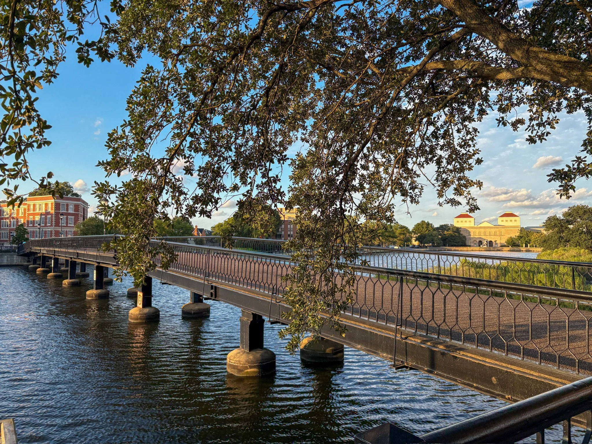
photo credit (jenniferdawnrealestate.com)

This Norfolk relocation guide links to NPS, VA DOE, GreatSchools to help parents research directly.
Learning in Norfolk
Education is a key factor for many families relocating to Norfolk. Below are resources for public schools, higher education, and private/alternative options. To remain Fair Housing–compliant, we provide factual resources and direct links so parents and students can explore and decide what best fits their needs.
Norfolk Public Schools
- Serves ~30,000 students across elementary, middle, and high schools.
- Parents can check Norfolk Public Schools for attendance zones, calendars, and district news.
- Performance and accountability data available through the Virginia DOE School Quality Profiles.
- Independent ratings and reviews at GreatSchools.org.
Higher Education
- Old Dominion University (ODU): research university with ~23,000 students.
- Norfolk State University (NSU): historically Black university, part of the VA public system.
- Eastern Virginia Medical School (EVMS): nationally known for medicine and health sciences.
- Tidewater Community College (TCC): offers associate degrees and workforce training.
Private & Alternative Options
- Norfolk offers a range of independent and parochial schools at elementary and secondary levels.
- Families can explore options via Private School Review or local school websites.
Find Your School Zone
Boundaries and profiles change. Use the official lookup tools to confirm the most current info for a specific address.
- Norfolk Public Schools — Boundary Lookup
- Virginia DOE — School Quality Profiles
- GreatSchools — Norfolk
Last verified: October 2025
School data and ratings are provided by third-party and state sources. Information is deemed reliable but not guaranteed. Families are encouraged to verify directly with Norfolk Public Schools, the Virginia Department of Education, and GreatSchools.org.

Mermaids of Norfolk
Norfolk’s mermaids are an iconic public-art series: hand-painted sculptures displayed across neighborhoods, plazas, and waterfront corridors. Originally, 130 fiberglass mermaids were cast for artists and sponsors; today the exact number on display changes as pieces are added, moved, or restored. Use the official map resources below to plan a self-guided mermaid scavenger hunt.
Mermaids are Norfolk’s beloved public-art icons—colorful sculptures you’ll spot around downtown, neighborhoods, and the waterfront. They’re an unofficial city mascot and a fun scavenger hunt for new residents.
Where You’ll See Them
- Downtown & Waterside: Granby Street, Town Point Park, around Waterside District.
- Ghent & NEON: near Colley/21st, Chrysler Hall/Scope plazas, arts corridors.
- Freemason & Fort Norfolk: historic blocks, courtyards, and cultural venues.
- Along the ERT: watch for pieces near Elizabeth River Trail segments.
Hunt Tips
- Start downtown and follow the waterfront toward Nauticus & Waterside, then loop into NEON or Ghent.
- Daylight shows details best; evening walks pair well with lit plazas and the ERT’s Glowline.
- Mermaids can move for maintenance; check the interactive map before you go.
Launched in 1999, “Mermaids on Parade” commissioned sculptor Kevin Gallup to cast 130 fiberglass mermaids, later decorated by local artists and adopted by businesses and civic groups. The mermaid has since become a city symbol featured across districts and public spaces.
Explore the latest locations here:
- Download a blank map from the Mermaid Trail page and mark each find as you go.
- Suggested route: Harbor Park → Town Point Park/Waterside → Nauticus → Freemason → Granby → NEON → Ghent.
- Mermaids can move for maintenance—verify locations before you head out.
Pieces are occasionally relocated or refreshed. For the most up-to-date list, use the interactive maps above before you head out.
Last verified: January 2025 · Some sculptures may move or be refurbished.
- City of Norfolk — Norfolk Mermaids & Mermaid Interactive Spotting Map.
- Norfolk Arts — CivicLab Open Data mermaid map & public art registry.
- VisitNorfolk — Mermaid Trail, walking maps, and guides.
Mermaid counts and locations change as pieces are installed, restored, or moved. Verify current displays with the City of Norfolk, Norfolk Arts, and VisitNorfolk links above.
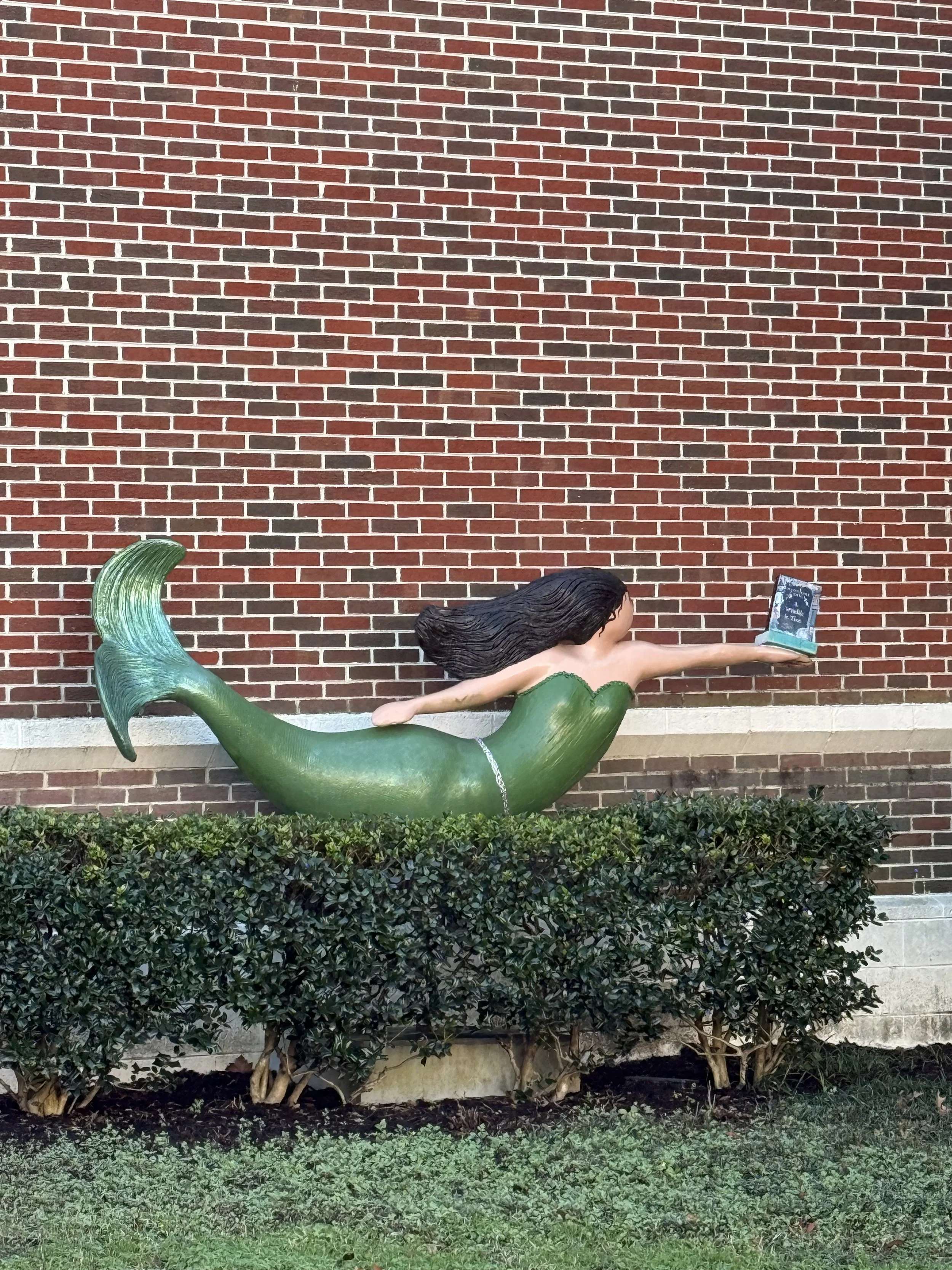
photo credit (jenniferdawnrealestate.com)
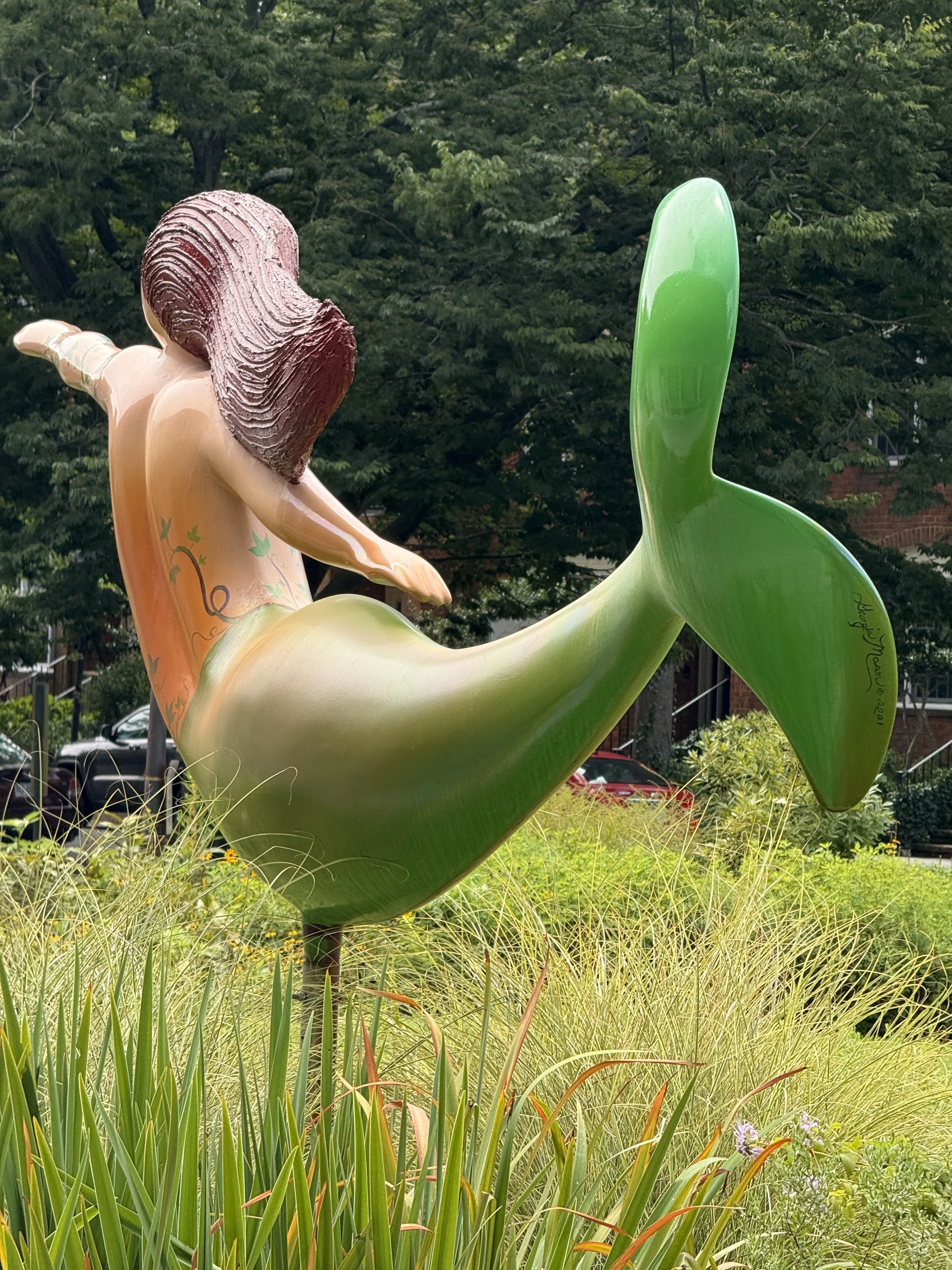
photo credit (jenniferdawnrealestate.com)

photo credit (ArcGIS)
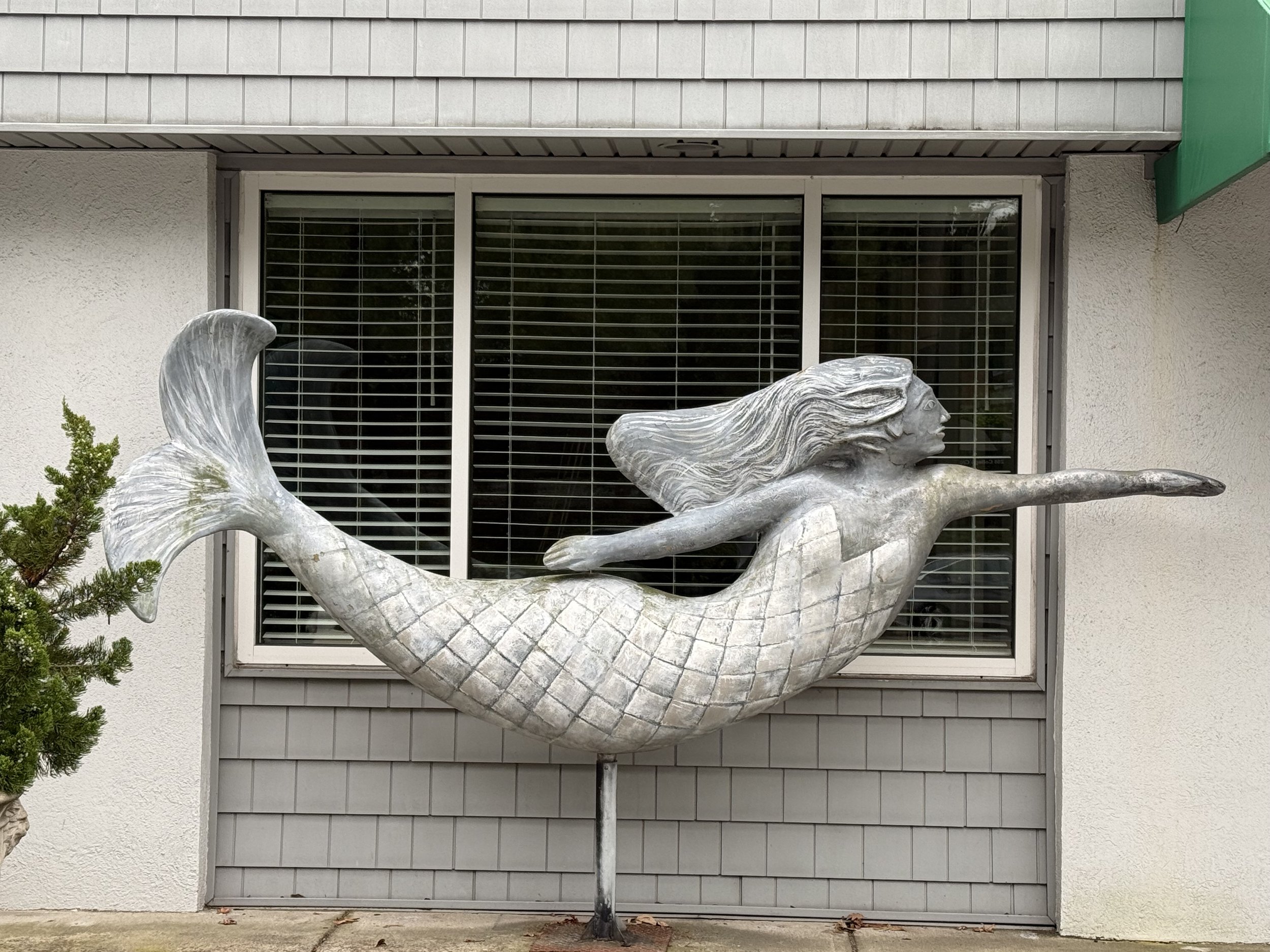
photo credit (jenniferdawnrealestate.com)


Serving Here: Bases, Community & Resources
Hampton Roads is one of the nation’s largest military communities. Below are official resources for key installations, on-base services, PCS support, and everyday life—kept strictly factual and linked to authoritative sites.
Major Installations (Official)
- Naval Station Norfolk — Base homepage · MWR/FFSC directory
- Naval Support Activity Hampton Roads — Base homepage · NATO ACT
- JEB Little Creek–Fort Story — Base homepage · MWR directory
- NAS Oceana — Dam Neck Annex — Base homepage · Visitor info
On-Base Services & Support
- Commissary/Exchange/MWR — see installation MWR pages above for gyms, recreation, tickets, childcare & more.
- Fleet & Family Support / A&FRC — counseling, transition, classes; see base directories.
- Healthcare (TRICARE East) — TRICARE Regions · TRICARE East overview · Humana Military portal
PCS & Relocation Support
- Step-by-step — orders → housing search → shipments → school enrollment → arrival; coordinate timelines early.
- Official welcome & sponsors — CNRMA contacts · NATO ACT Newcomers · JEBLCFS contacts
- Family programs — childcare, youth, Gold Star, wounded warrior: NRMA resources
- Your local guide — Norfolk area help, virtual tours, VA-loan savvy: Jennifer D · Military Relocation
Commute, Access & AICUZ Awareness
- Gate access & hours — always confirm on the specific base website before travel.
- Typical drive windows — central Norfolk to bases can range ~10–25 minutes depending on time of day and gate traffic.
- AICUZ noise/clear zones — review official maps prior to purchase: City of Norfolk AICUZ (2020) · NS Norfolk AICUZ study
Healthcare & Referrals
- TRICARE East — region overview · beneficiary portal
- Referrals — some specialty care requires a clinic referral; confirm on base or via Humana Military.
- Emergency care — use nearest ER; follow TRICARE guidance for notifications/claims.
FAQs for Military Moves
- Buy before arrival? Yes—remote showings, secure e-sign, and coordinated closing available: learn more.
- VA appraisal questions? I coordinate with VA-savvy lenders/appraisers and guide expectations.
- Timeline pressure? We tailor search/offer/close to PCS dates; typical financed closing ~30 days.
- Sell & buy coordination? Seamless listing + purchase planning aligned to orders and leave.
PCS orders?
I’m a Military Relocation Professional (MRP)—let me guide your move.
Resources above link to official installation and program sites. Availability and procedures may change.
- Naval Station Norfolk (CNIC) · NSN MWR/FFSC
- NSA Hampton Roads (CNIC) · NATO ACT
- JEB Little Creek–Fort Story (CNIC) · JEBLCFS MWR
- Dam Neck Annex (CNIC) · Visitor Info
- TRICARE Regions · TRICARE East · Humana Military
- City of Norfolk AICUZ (2020) · NS Norfolk AICUZ Study
- Jennifer Dawn Real Estate — Military Relocation
Base services, access, and procedures change; verify details with official installation resources. Neighborhood references are for geographic orientation (City/official designations) and are not recommendations.

Norfolk Neighborhoods
Explore Norfolk VA neighborhoods
If you’re moving to Norfolk VA, this is your orientation.
Norfolk Neighborhoods (City Designations)
Historic, walkable streets
Examples include Ghent and Larchmont (city-designated areas). Built form and walkability vary by block—verify by address.
Water + Bayfront access
Examples include Ocean View and Willoughby. Public access points and conditions vary—check official resources before visiting.
Downtown condo + amenities
Examples include Downtown Norfolk and the NEON District. Housing types and walkability vary within each area.
Not sure where you fit? Book a 15-minute fit check → Neighborhood references are for orientation only and are not recommendations.
These neighborhoods are designated by the City of Norfolk and highlighted by VisitNorfolk. Information is provided for orientation only and is not a recommendation.
Curious which neighborhood might fit your goals? Explore my Buyer Hub or schedule a consult.
Neighborhood Map & Data
Ghent
- Early-20th-century grid; Colonial Revival, Arts & Crafts, Tudor styles; multiple historic overlays.
- Anchors: Colley Ave/21st corridors, Christ & St. Luke’s, Stockley Gardens (Art Show), Mermaid Winery.
- Events: Stockley Gardens Art Show (spring/fall).
- Commute (typical): ~5–10 min to Downtown; ~15–20 min to Naval Station (gate/traffic dependent).
- Walk/Bike: Core blocks are walkable; bike connections into NEON and the ERT. Check Walk Score® for specific addresses.
Freemason Historic District
- One of Norfolk’s oldest intact areas; cobblestone segments and alleys; Federal/Victorian/early 20th-c. homes; loft conversions.
- Anchors: Granby & Waterside, Town Point Park, Nauticus/Wisconsin, Half Moone.
- Events: Harborfest, Bayou Boogaloo (Town Point Park).
- Commute: Immediate Downtown access; ~15–20 min to Naval Station.
- Walk/Bike: Highly walkable Downtown adjacency; ERT segments at the waterfront.
Downtown Norfolk
- Cultural/civic core; theaters, arenas, museums; housing includes lofts and high-rises.
- Anchors: Chrysler Hall, Scope Arena, Granby dining, Waterside District, MacArthur Memorial & Plaza.
- Events: seasonal shows and festivals (verify calendars).
- Commute: Central for Downtown employers; ~15–25 min to Naval Station.
- Walk/Bike: Walkable core; bikeshares and transit (The Tide) nearby.
VisitNorfolk guide: Downtown Norfolk →
NEON District
- Arts corridor known for murals, galleries, and events; adjacent to Downtown civic and venue areas.
- Anchors: NEON Festival footprint, arts programming, nearby Chrysler Hall/Scope plaza.
- Commute: Central; ~15–25 min to Naval Station (time-of-day dependent).
- Walk/Bike: Walkable core; transit nearby.
VisitNorfolk guide: NEON District →
Chelsea / West Ghent
- Maker corridor by the Elizabeth River; brewery cluster and small eateries; adjacent to Ghent blocks.
- Anchors: ERT segments, Chelsea Paddle Launch, Smartmouth & Benchtop; near ODU/EVMS/Sentara.
- Commute: ~5–10 min to Downtown; ~15–20 min to Naval Station.
- Walk/Bike: ERT access; short bike to Ghent/Downtown; verify per address.
Larchmont / Edgewater
- River-adjacent neighborhoods along Lafayette/Elizabeth waterways; tree-lined streets.
- Anchors: ODU proximity, library/schools, neighborhood parks, ERT connectors.
- Commute: ~10–15 min to Downtown; ~15–25 min to Naval Station.
- Walk/Bike: Local park loops; bike links to ODU/ERT vary by corridor.
Colonial Place / Riverview
- Interlocking neighborhoods on the Lafayette River with a popular riverfront loop; bungalows, foursquares, Colonial Revival.
- Anchors: Granby corridor, Riverview retail node, Virginia Zoo nearby.
- Commute: ~10–15 min to Downtown; ~15–25 min to Naval Station.
- Walk/Bike: River loop is a local favorite; Walk/Bike varies by block—check per address.
Lochhaven
- Between the Lafayette and the Elizabeth; 1920s–1950s housing; some waterfront parcels.
- Anchors: Hermitage Museum & Gardens, Norfolk Yacht & Country Club; ODU access.
- Commute: ~10–15 min to Downtown; ~15–25 min to Naval Station.
- Walk/Bike: Neighborhood loops; river proximity; verify per address.
Lafayette-Winona
- Historic residential fabric along the Lafayette; Craftsman, foursquare, vernacular styles; mature canopy.
- Anchors: River access points, neighborhood parks; corridor links into Ghent/ODU.
- Commute: ~10–15 min to Downtown; ~15–25 min to Naval Station.
- Walk/Bike: Local loops; bike links vary by segment—verify per address.
Ocean View / East Beach
- Chesapeake Bay shoreline with public beaches and fishing pier; East Beach is New Urbanist-planned.
- Anchors: Ocean View Beach Park, seasonal events, access to JEB Little Creek–Fort Story.
- Commute: ~15–25 min to Downtown; ~10–20 min to Little Creek (gate/traffic dependent).
- Walk/Bike: Beachside paths/parks; check local segments for biking.
VisitNorfolk guide: Ocean View →
Lambert’s Point
- River-edge near port and ODU; greenway views and golf range; early- to mid-20th-c. housing.
- Anchors: Lambert’s Point Golf, ERT adjacency, ODU athletics/campus access.
- Commute: ~8–12 min to Downtown; ~15–22 min to Naval Station.
- Walk/Bike: ERT proximity; local loops—verify per address.
Fort Norfolk (Downtown/Medical Edge)
- Waterfront/medical edge with mid-/high-rise living; The Tide (Fort Norfolk station).
- Anchors: EVMS & Sentara campuses; Waterside & riverfront ERT nearby.
- Commute: Central to medical/civic; ~15–25 min to Naval Station.
- Walk/Bike: Transit-friendly; walkable to select amenities.
Other Areas (City-Designated)
- Norview / Ingleside / Fairmount Park: primarily mid-20th-c. homes; arterial access.
- Wards Corner: central commercial node; mixed housing eras; I-64 access.
- Berkley / Campostella: south-of-river corridors with bridge access to Downtown.
Waterfront & Districts
Waterside District, Pagoda & Garden, Harbor Park, City Cruises.
Museums & Landmarks
Chrysler Museum & Glass Studio, Nauticus & Wisconsin, Hermitage.
Parks, Trails & Bay
ERT Glowline, Town Point Park, Ocean View & East Beach.
Neighborhood Snapshot — Side by Side
Ghent
- Housing: Colonial Revival, Craftsman, Tudor
- Commute: ~5–10m Downtown · ~15–20m NSN*
- Walk/Bike: Core blocks walkable; bike to NEON/ERT
Ocean View / East Beach
- Housing: Cottages, townhomes, condos
- Commute: ~15–25m Downtown · ~10–20m JEB*
- Walk/Bike: Beach paths, bayside parks
Downtown / NEON
- Housing: High-rise condos, lofts, adaptive reuse
- Commute: Central · ~15–25m NSN*
- Walk/Bike: Transit, bikeshares; highly walkable
* Commute windows vary by gate, time of day, and tunnel traffic.
Next Step: Explore or Chat
Neighborhood snapshots are a starting point. Explore more resources or schedule a quick consult to talk through your goals in Norfolk.
- Buyer Resource Hub — step-by-step guides, tools, and checklists.
- Email Jennifer: jennifer@jenniferdawnnrealestate.com · Call/Text: (757) 524-0417
Neighborhood references are for orientation only and are not recommendations.
- City of Norfolk — Maps & Data (official map resources)
- City GIS Experience — Neighborhood Map (interactive)
- VisitNorfolk — Neighborhood Overviews
- Elizabeth River Trail Foundation
Commute times, events, and walk/bike conditions vary by time of day and exact address; verify with official sources and on-the-ground visits. Neighborhoods listed reflect City of Norfolk designations and VisitNorfolk highlights. This is orientation only, not a recommendation.

photo credit (norfolk.photodeck.com)
Set Up Your Norfolk Essentials
Getting settled means more than finding a home. Use these official links and contacts to set up utilities, city services, internet, voter registration, DMV, and more.
Electric — Dominion Energy (VA)
- Start/Stop/Move Service
- Outages & Restoration
- Customer Care: 866-366-4357
Water / Sewer — City of Norfolk
- Department of Utilities (service, billing, leaks)
- Customer Service: 757-664-6700
- After-Hours Emergencies: 757-664-6700
Natural Gas — Virginia Natural Gas
- Start/Stop/Move Service
- Customer Care: 866-483-0647
- Gas Emergency (24/7): 877-766-9642
Regional Wastewater — HRSD
- HRSD Customer Service & Billing
- Customer Care: 757-485-9500
Trash, Recycling & Bulk Pickup — Norfolk
- Waste Management (schedules, carts, bulk, HHW)
- Norfolk Cares (service requests): 757-664-6510
- Submit a 311 Request Online
Internet & TV Providers (verify by address)
City Services — Norfolk Cares
- Norfolk Cares Center: 757-664-6510
- City of Norfolk Portal · Resident Services Directory
Police / Fire / Emergencies
- Emergencies: Call 911
- Police Non-Emergency (dispatch): 757-441-5610
- Norfolk Fire-Rescue (admin info)
DMV & Voter Registration
- Virginia DMV · Customer Service: 804-497-7100
- Register to Vote — VA Dept. of Elections
- Norfolk Voter Registration
Pets: Licensing & Animal Care
Hospitals & Healthcare Anchors
Transit & Travel (Quick Links)
Parking, Garages & Residential Permits
- Norfolk Parking Division (garages, monthly passes, citations)
- Residential Parking Permits (RPP)
- Parking Customer Service: 757-642-2760
Permits, Inspections & Zoning
Floodplain, Storms & Evacuation
- Jennifer’s Guide: Understanding Flood Zones (Buyer/Seller Explainer)
- Norfolk Floodplain & Insurance Info · FEMA Flood Map
- Know Your Zone (VA Evacuation)
Tip: Flood risk, insurance, and elevation are address-specific. Verify for each property.
Short-Term Rentals (STR)
Tip: STR approvals vary by zoning and dwelling type; check the ordinance and permit portal for current requirements.
AICUZ / Noise & Clear Zones
- Jennifer’s Guide: AICUZ & Noise Contour / AZP Explainer (applies regionally)
- Norfolk references: see Military section for base AICUZ studies and links.
Tip: Noise and clear zones can affect financing, insurance, and certain improvements. Confirm layers for each address.
City Taxes & Payments
Local Insights (Jennifer Dawn)
More Local Context
- City of Norfolk · Resident Services · 311 / Norfolk Cares
- Dominion Energy Virginia · Virginia Natural Gas · HRSD
- Virginia DMV · Virginia Dept. of Elections
- Hampton Roads Transit · ORF Airport · Amtrak Norfolk
- Norfolk Parking · ePermits · STR Page
- Jennifer Dawn — Norfolk · Flood Zones · AICUZ / AZP Guide
Links and phone numbers are provided for convenience and may change. Always confirm details (service areas, hours, fees) directly with each provider.
Download My Norfolk Relocation Kit (Free)
All the essentials in one place: neighborhoods, schools, utilities, buyer checklist, flood & AICUZ primers, commute tools, and local contacts.
- Neighborhood & commute cheatsheets
- School/resource links (GreatSchools, VA DOE, NPS)
- Flood & AICUZ quick guides (what to check)
- Utilities & setup, voter/DMV links
- Buyer timeline & show-ready checklist
I’ll also send a quick note with any relevant updates; unsubscribe anytime.
After submitting the form, click “I’ve submitted” below to unlock the download.
Tip: bookmark this page for quick reference during tours.
Resources are provided for general orientation and may change. Always verify details with official sources.
Quick Commutes — and a Calculator for Your Route
Downtown & NEON
Typical drive from central Norfolk: ~8–15 minutes.
Naval Station Norfolk
Typical drive windows: ~15–25 minutes (gate & traffic dependent).
Little Creek–Fort Story
Typical drive windows: ~10–20 minutes to JEB (time of day varies).
ORF Airport
Most trips: ~12–18 minutes door to door.
ODU / EVMS / Sentara
Campus & hospitals: ~5–12 minutes for most central routes.
Waterside District
Dining & events: ~8–12 minutes (event nights vary).
Commute Calculator (opens in Google Maps)
- AM peak (approx. 7:00–9:00): Allow extra time for tunnels/bridges and base gates. E-ZPass helps at Midtown/Downtown Tunnels.
- PM peak (approx. 4:00–6:30): Backs up near Downtown/NEON, Waterside, and around gate shift changes.
- Shoulders (before 7:00 / after 6:45): Often smoother; check live conditions before you go.
- Check live: VDOT 511 Virginia · DriveERT status · HRT Alerts
- Scope/Chrysler Hall: Arrive early; consider garage pre-pay. SevenVenues Calendar
- Harbor Park (Norfolk Tides): Game nights add traffic around Waterside/Granby. Schedule
- Town Point Park festivals: Harborfest, Bayou Boogaloo impact nearby streets. Festevents
- Transit option: Park-&-Ride then take The Tide to Downtown/NEON; the Elizabeth River Ferry can help for Norfolk ↔ Portsmouth.
- Midtown vs. Downtown: If one tunnel slows, try the other; HRBT (I-64) can be a longer detour but sometimes faster.
- Live reroutes: Use Google Maps/Waze + 511 Virginia for closures and best lanes in real time.
- Ferry option: Elizabeth River Ferry can bypass short Downtown tie-ups (Norfolk ↔ Portsmouth).
Favorite Parking Garages (Downtown • Freemason • Waterside)
Waterside Garage
Closest for Waterside District, Town Point Park, Harbor Park.
Bank Street Garage
Great for Freemason, MacArthur area, SevenVenues events.
Freemason Street Garage
Short walk to Freemason cobblestones, Granby dining, Chrysler.
MacArthur Center Garages
Good for Granby St., NEON, and Downtown venues (event nights vary).
Park-&-Ride + The Tide
Park once and ride Light Rail to Scope/Chrysler/NEON/Downtown.
Rates, hours, and event pricing change; verify on the Norfolk Parking portal. Consider pre-pay on busy event nights.
Want to test-drive Norfolk living?
Let’s schedule a day to explore neighborhoods, amenities, and the rhythm of daily life together.
Schedule a Visit →Norfolk & Hampton Roads Map Explorer
Interactive map of Norfolk VA neighborhoods, nearby bases, and popular Hampton Roads day trips — curated for Jennifer Dawn REALTOR® Norfolk relocation guide.
Interactive map of Norfolk VA neighborhoods, bases, and popular Hampton Roads day trips—
curated by Jennifer Dawn’s Norfolk relocation guide.
From Downtown Norfolk (Waterside): Distances & Day Trips
Times shown are mid-day typical from Waterside District, 333 Waterside Dr; allow more during peak periods.
Nauticus & Battleship Wisconsin
Maritime museum & historic battleship on the Elizabeth River.
≈ 2–5 min • adjacent from Waterside. Parking nearby.
Town Point Park / Waterside
Festival lawn, riverfront events, and dining at Waterside District.
≈ 2–5 min • adjacent (onsite).
Selden Market
Indie shops & pop-up eats in Downtown.
≈ 3–6 min (short walk/drive).
Chrysler Museum of Art & Glass Studio
Renowned collection + live glassblowing demos.
≈ 5–8 min • 1 mi from Waterside.
Harbor Park (Norfolk Tides)
AAA baseball on the riverfront.
≈ 4–7 min • 1 mi from Waterside.
Virginia Zoo
Zoo with global habitats.
≈ 8–12 min • 3 mi from Waterside.
Elizabeth River Trail (Glowline segment)
Waterfront multi-use trail; night-lit art segment.
≈ 6–10 min • 2 mi to common access points from Waterside.
Norfolk Botanical Garden
175 acres of gardens & seasonal events.
≈ 14–18 min • 7 mi from Waterside.
Chartway Arena (ODU)
Concerts & Monarch basketball.
≈ 10–14 min • 4 mi from Waterside.
VB Oceanfront & Boardwalk
3-mile boardwalk, beaches, dining & events.
≈ 25–35 min • 18 mi from Waterside. Peak summer/holiday times vary.
Virginia Aquarium & Marine Science Center
Exhibits, marsh boardwalks, boat tours (seasonal).
≈ 25–35 min • 17 mi from Waterside.
First Landing State Park
Trails, bay beach, and maritime forest.
≈ 25–35 min • 16 mi from Waterside.
Cape Henry Lighthouse (Fort Story)
Historic lighthouse with Atlantic views (ID requirements at gate).
≈ 30–45 min • 21 mi from Waterside; bring photo ID for base access area.
Mount Trashmore Park
Park with trails, playgrounds, and lake views.
≈ 18–25 min • 12 mi from Waterside.
Sandbridge Beach
Quieter Atlantic beach south of the resort area.
≈ 35–50 min • 24 mi from Waterside (seasonal traffic varies).
Children’s Museum of Virginia
Hands-on museum for kids, Olde Towne nearby.
≈ 8–15 min • 2 mi via Downtown Tunnel (traffic varies).
Olde Towne Waterfront
Historic streets, restaurants, and ferry to Norfolk.
≈ 8–15 min • 2 mi via Downtown Tunnel; ferry also available.
Buckroe Beach
Chesapeake Bay beach & events north of HRBT.
≈ 25–40 min • 18 mi via I-64/HRBT (tunnel traffic varies).
Fort Monroe National Monument
Historic fort, bay views, and museum.
≈ 25–40 min • 16 mi from Waterside via HRBT.
Colonial Williamsburg
Living-history district & museums (day trip).
≈ 50–75 min • 45 mi from Waterside.
Busch Gardens Williamsburg
Theme park (seasonal hours) — day trip favorite.
≈ 45–65 min • 48 mi from Waterside.
Yorktown Battlefield / American Revolution Museum
Historic battlefield & museum on the York River.
≈ 45–65 min • 42 mi from Waterside.
Mariners’ Museum & Park (Newport News)
Maritime history + 550-acre park.
≈ 25–40 min • 22 mi from Waterside via HRBT.
Virginia Living Museum (Newport News)
Virginia wildlife & science center.
≈ 30–45 min • 27 mi from Waterside.
CBBT Scenic Overlook / ES Welcome Center
First stop over the bridge–tunnel; bay views & info.
≈ 30–45 min • 22 mi from Waterside (toll facility).
Cape Charles Waterfront
Walkable bayside town with beach & shops.
≈ 60–80 min • 48 mi from Waterside (includes CBBT toll).
Great Dismal Swamp Refuge Trails
Wildlife refuge with boardwalks & canal trails.
≈ 35–55 min • 22 mi to common trailheads (Washington Ditch).
What’s On This Month
- Town Point Park & Festevents calendar
- Scope & Chrysler Hall events (SevenVenues)
- VisitNorfolk events & seasonal festivals
- City Cruises Norfolk (dinner & specialty sails)
Dreaming beyond Norfolk?
I’ll help you compare homes across Hampton Roads.
Schedule an Appointment →
Norfolk FAQs — Living, Moving & Real Estate
Norfolk is known for the world’s largest naval base, a waterfront arts scene (Chrysler Museum, Perry Glass Studio, NEON), festival lawns on the Elizabeth River, and the city’s mermaid public art.
Yes—Norfolk has Chesapeake Bay shoreline along Ocean View & East Beach with public access points and seasonal activity.
On-base access is restricted. For views of the base and surrounding waterways, check narrated harbor cruise options and official visitor guidance.
- Virginia Beach: often ~20–35 minutes
- Williamsburg: often ~50–75 minutes
- Richmond: often ~1.5–2 hours
- Washington, D.C.: often ~3–3.5 hours
Times vary with traffic (tunnels/bridges). See Mobility & Getting Around and Distances & Day Trips.
Norfolk has a four-season coastal climate with warm/humid summers, generally mild winters, and spring/fall shoulder seasons. Hurricane season runs June–November.
The City of Norfolk’s Real Estate Tax FAQ lists the current real estate tax rate as $1.23 per $100 of assessed value and publishes installment due dates. Rates are approved annually—verify on the official page.
Flood risk is address-specific. Use Norfolk’s flood zone resources and FEMA MSC to confirm a property’s official zone; lenders may require insurance depending on zone and loan type.
Norfolk requires registration/permits and zoning compliance for short-term rentals. The City’s published guidance includes a 9% lodging/transient occupancy tax.
Effective January 1, 2026, Norfolk changed how the room tax is calculated for short-term rentals to $3 per night per room/bedroom. Because ordinances and guidance can be amended, verify current rates, definitions (e.g., how “room/bedroom” is applied), and filing instructions on the official pages before operating.
BAH updates annually (effective January 1). Use the official DoD BAH Rate Lookup to view 2026 rates for the Virginia Beach–Norfolk MHA by pay grade and dependency status.
Some Norfolk neighborhoods use Residential Parking Permit (RPP) zones. If your address is inside an RPP area, apply online and review the official zone map and program rules.
City rules, tax rates, maps, and BAH rates change periodically. Always verify through the official links provided above. Internal links provide general guidance and are not legal, tax, or financial advice.
Didn’t see your question here?
Ask me directly and I’ll answer personally.
Email Jennifer →Why Work With Jennifer D
Military Relocation Expertise
MRP designation with deep PCS experience—timelines, BAH, gate access, and off-base housing. Clear guidance for service members and families navigating a move.
Community-Rooted, Local Insight
President of the Fred Heutte Garden Foundation and an active community advocate—offering insight beyond listings, from neighborhoods and schools to flood zones and commute patterns.
Client Stories from Buyers & Sellers Like You
A few highlights—because the best compliment is being invited into someone’s biggest move.
“Hiring Jennifer to sale our house was the best decision we could’ve ever made… professionalism, knowledge, warm-winning spirit. She gets the job done. Her team is phenomenal.”
“My house was on the market for 3 days and had 22 showings and 7 offers. 10/10 would recommend every time.”
“Keep in mind I was literally on the other side of the country when we went through the sales process… I could not have asked for a more on the ball, level headed, involved Real Estate Agent.”
“Jennifer was wonderful to work with! She made the entire process as easy as possible for me purchasing my first home. I always felt like I was in good hands.”
“Jennifer is the most relentless agent one could ever want… I’m a Huge fan and i invite you to be come one as well.”
“Jennifer is an absolute rockstar! She went above and beyond… 10/10 would recommend, undoubtedly the finest realtor in Hampton Roads.”
More Client Stories & Experiences
More notes from buyers and sellers across Hampton Roads—different situations, same goal: a smooth, confident move.
“Jennifer is so amazing! Her marketing… above and beyond… always answered our questions… every step of the way of both selling and buying.”
“Hands down the best Real Estate Agent… bought and sold several homes… no one will work harder… ‘above and beyond’ is an understatement.”
“Jennifer has been our realtor for years… patient, kind, friendly… assisted us in negotiating the best price point.”
“Working with Jennifer… honest input, frequent communication… strong negotiator… truly a nice lady… first call if relocating again.”
Exploring Hampton Roads?
Let’s talk about homes that fit your lifestyle and timeline—virtually or in person.
Schedule a Consult