
Explore Hampton Roads, Virginia
Seven cities. Miles of waterfront. One region with a lot to discover.
Hampton Roads stretches from the Chesapeake Bay to the Atlantic Ocean and across a network of rivers, harbors, cities, and communities with their own local character. This guide is your starting point for exploring the region itself—from its seven independent cities and waterfront geography to parks, history, arts, food, events, and the local resources that help you discover more.
Explore the Seven Cities
Start with Norfolk, Virginia Beach, Chesapeake, Portsmouth, Suffolk, Hampton, and Newport News, then go deeper with each city's dedicated guide.
Meet Hampton RoadsDiscover the Region
Explore waterfronts, parks, historic places, arts and culture, local experiences, events, and other ways to get to know Hampton Roads.
See What’s HerePlanning a Move?
If you're researching Hampton Roads because you're relocating, continue to the dedicated guide for transportation, housing criteria, property research, and move logistics.
Hampton Roads Relocation GuideMeet Hampton Roads
Hampton Roads is not a single municipality. It is a connected region of independent cities shaped by the Chesapeake Bay, Atlantic Ocean, rivers, harbors, and the communities that have developed around them. Each city has its own geography, local government, public resources, housing inventory, and places to explore.
Southside
The Southside includes five of the seven cities featured throughout this guide and stretches across the region south of Hampton Roads harbor.
Peninsula
Hampton and Newport News sit on the Peninsula side of the region.
Norfolk
Norfolk sits along the Elizabeth River and Chesapeake Bay and includes a downtown waterfront, historic residential areas, cultural institutions, maritime activity, major military facilities, parks, and distinct commercial districts.
Explore NorfolkVirginia Beach
Virginia Beach stretches from the Chesapeake Bay to the Atlantic Ocean and includes oceanfront and bayfront areas, extensive parkland, residential and commercial districts, military installations, waterways, and agricultural areas.
Explore Virginia BeachChesapeake
Chesapeake covers a large portion of the Southside and includes residential areas, commercial corridors, waterways, forests, agricultural land, historic resources, and connections to several major regional transportation routes.
Explore ChesapeakePortsmouth
Portsmouth occupies the western side of the Elizabeth River opposite Norfolk and includes historic districts, waterfront areas, museums, maritime facilities, residential communities, parks, and direct tunnel connections across the river.
Explore PortsmouthSuffolk
Suffolk is geographically expansive and includes an urban center, established residential areas, newer development, agricultural land, parks, waterways, historic sites, and connections to both Southside and Peninsula routes.
Explore SuffolkHampton
Hampton borders the Chesapeake Bay and Hampton Roads harbor and includes waterfront areas, historic sites, beaches, parks, residential communities, Langley Air Force Base, and access to the Hampton Roads Bridge-Tunnel.
Explore HamptonNewport News
Newport News extends along the James River and includes residential areas, parks, museums, maritime and industrial activity, higher-education institutions, historic resources, and regional transportation connections.
Explore Newport NewsYou Can't Really Understand Hampton Roads Without Understanding the Water
Hampton Roads developed around one of the world's largest natural harbors and a network of bays, rivers, creeks, and coastline. The water isn't simply scenery here—it is part of the region's geography, history, maritime economy, recreation, transportation, and everyday sense of place.
The Chesapeake Bay meets the Atlantic Ocean at the eastern edge of the region. The James River reaches Hampton Roads from the west, while the Elizabeth River winds through Norfolk, Portsmouth, and Chesapeake. The Nansemond River runs through Suffolk, and countless smaller waterways, inlets, wetlands, and tidal creeks shape the landscape in between.
Look at Hampton Roads from above and the name suddenly makes sense: this is a region connected—and divided—by water.
There’s More Than One Way to Get Outside Here
Hampton Roads meets the outdoors in a lot of different ways. Chesapeake Bay beaches give way to dunes and maritime forest, rivers and tidal waterways wind through the region, and parks, gardens, trails, preserves, lakes, and urban waterfront spaces offer still more ways to experience Coastal Virginia.
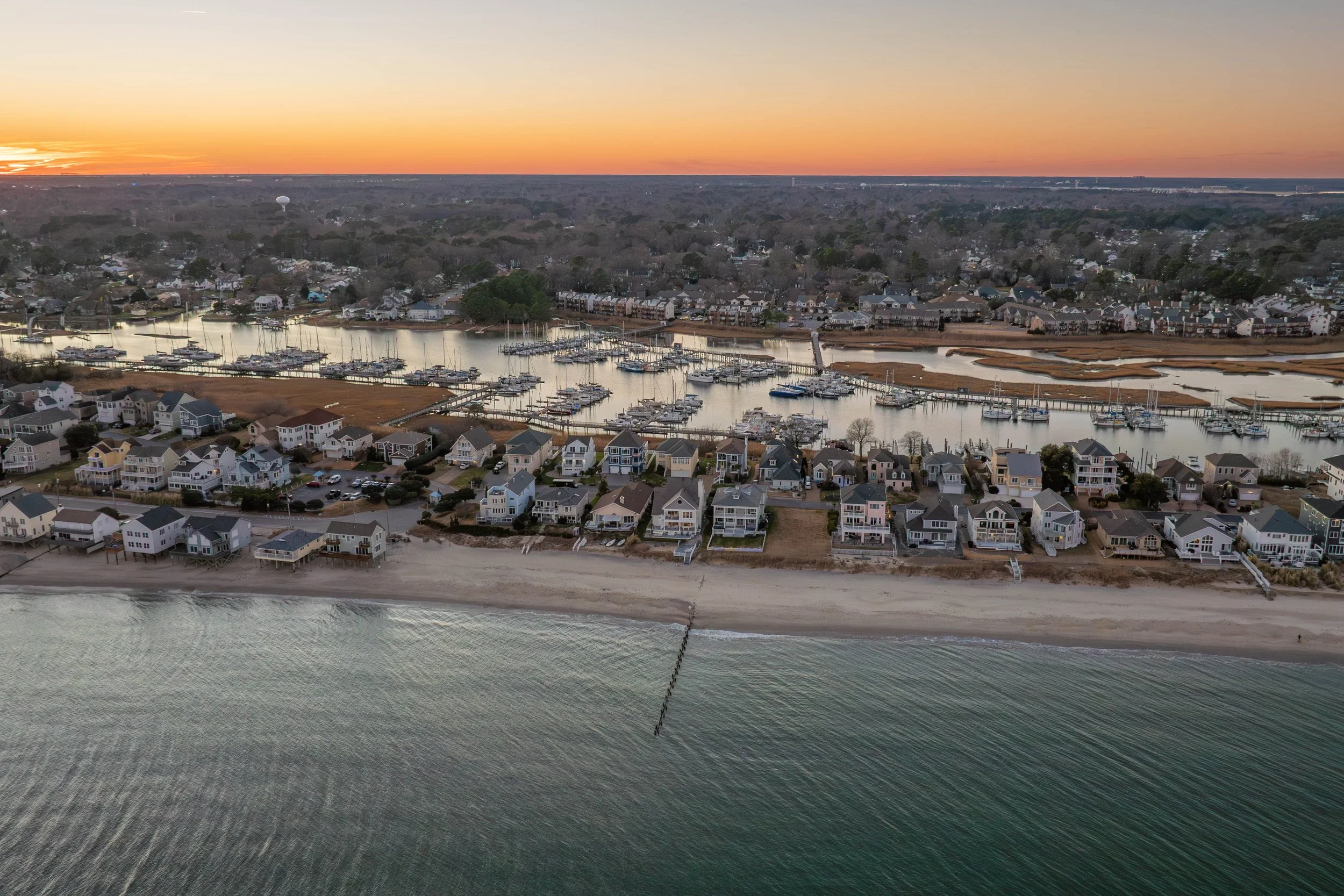


Along the Chesapeake Bay, places such as Buckroe Beach in Hampton and the Bay side of Virginia Beach show one side of the region outdoors. Travel farther inland and the landscape changes again: maritime forest and wetlands, rivers and creeks, wooded trails, lakes, gardens, working waterways, and preserved natural areas all become part of the picture.
First Landing State Park and Norfolk Botanical Garden are two examples, but the outdoor story stretches across Hampton Roads. Chesapeake reaches into the Great Dismal Swamp landscape with trails, forests, waterways, and its own arboretum. Suffolk adds lakes, river access, parks, and broad stretches of open land, while Newport News brings another extensive network of parks and trails to the Peninsula.
Across the seven cities, the experience can shift from beach to forest, garden to marsh, urban waterfront to quiet waterway. Whether you are discovering Hampton Roads for the first time or looking for somewhere new to explore close to home, the region offers far more than one version of the outdoors.
Keep Exploring Beyond the Photographs
The places pictured above are only three entry points. Chesapeake’s Dismal Swamp Canal Trail and Arboretum offer a very different landscape; Suffolk’s public water-access network reaches lakes, parks, and the Nansemond River; and Newport News maintains hiking and biking trails across the Peninsula. The point is not to build a checklist—it is to show how much the landscape changes as you move around Hampton Roads.
The Story of Hampton Roads Isn’t Told in Just One Place
Hampton Roads has been shaped by art, architecture, maritime history, military history, science, performance, industry, public spaces, and generations of people leaving their mark across the region. Some stories live inside museums. Others are built into streets, neighborhoods, theaters, waterfronts, historic sites, and working cultural spaces.
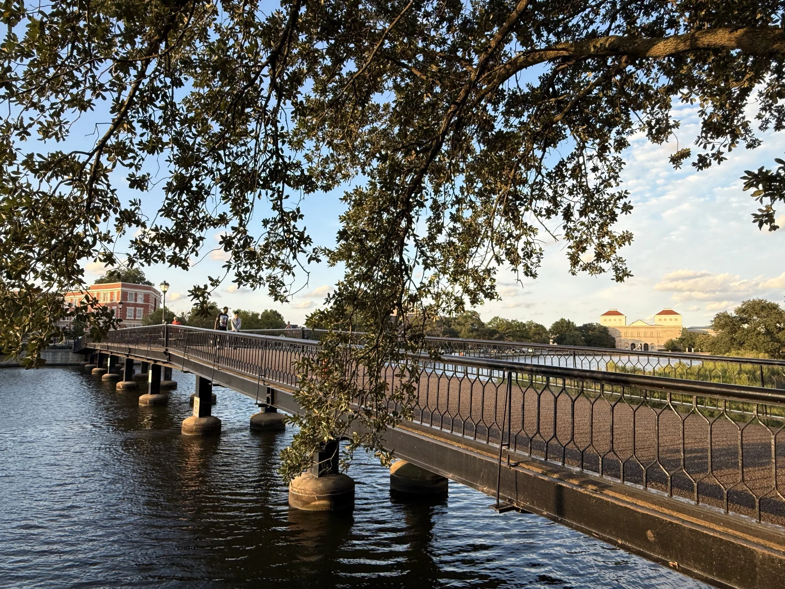
In Norfolk, the Chrysler Museum of Art and Perry Glass Studio connect an expansive art collection with working glassmaking and hands-on creative experiences. Across the Elizabeth River, Portsmouth’s Olde Towne and Cultural Arts District layer historic architecture with museums, galleries, public art, music, theater, festivals, and independent local businesses.
Hampton adds another dimension through Fort Monroe, local history institutions, and the Virginia Air & Space Science Center, where aviation and space exploration connect directly to the region’s NASA Langley story. Newport News expands the maritime side of the regional narrative through The Mariners’ Museum and Park, while Virginia Beach brings contemporary visual art and live performance into the mix through Virginia MOCA, the Sandler Center, and other cultural organizations.
Suffolk adds galleries, performance, local history, and the Suffolk Center for Cultural Arts. Chesapeake contributes its own layers through the Battle of Great Bridge, historic waterways, preservation, and community cultural programming. Together, those stories make Hampton Roads far more than a collection of individual attractions.

History That Still Lives in the Streetscape
Olde Towne brings historic architecture together with museums, galleries, theaters, public art, independent businesses, music, festivals, and events—creating a cultural district that extends well beyond a single building.

Where Regional History Reaches Into Space
Hampton’s story reaches from centuries of local history into aviation, aerospace, and NASA Langley. The Virginia Air & Space Science Center brings that science-and-innovation story into downtown Hampton.
Think of these as doors into the regional story, not a “best of” list. Hampton Roads has far more museums, historic places, performance spaces, galleries, community programs, and cultural institutions than could reasonably fit here. These examples are simply a few ways to begin exploring the region’s layered cultural story.
Local Life Looks Different Across Hampton Roads
One of the best ways to understand Hampton Roads is to look beyond the headline attractions. Farmers markets, downtown streets, independent businesses, neighborhood districts, seasonal festivals, restaurants, public spaces, working waterways, and local events reveal a different side of the region—one that both newcomers and longtime residents can keep rediscovering.

Downtown, Markets & Local Makers
Downtown Suffolk mixes historic streets, local businesses, cultural spaces, seasonal events, and a year-round farmers-market program that brings together produce, food, artisan goods, music, and community activity.

Waterways, Markets & Everyday Gathering Places
Chesapeake’s local life stretches from working waterways and historic Great Bridge to farmers markets, food events, parks, farms, and community spaces that reflect both the city’s developed corridors and its rural side.

Dining, Events & Modern City Life
Newport News adds another texture through mixed-use districts, dining, events, public art, cultural programming, and places such as City Center at Oyster Point alongside its older neighborhoods and historic areas.
The everyday rhythm changes from city to city. Norfolk has neighborhood commercial districts, markets, independent restaurants, arts spaces, and an active downtown. Portsmouth’s Olde Towne blends small businesses and historic streets with museums and waterfront events. Hampton’s downtown, Phoebus, waterfront, and seasonal programming offer yet another mix, while Virginia Beach ranges from resort-area activity to locally focused districts, markets, and events well beyond the Oceanfront.
Farther west, Suffolk’s farmers market, festivals, restaurants, arts, and downtown businesses sit alongside working farms and waterways. Chesapeake brings together markets, farms, food events, Great Bridge, South Norfolk, and extensive park and waterway networks. On the Peninsula, Newport News combines cultural programming, dining, mixed-use centers, maritime industry, neighborhood districts, and community events.
None of those experiences defines a city by itself. Together, they show why Hampton Roads is better understood as a collection of places with different rhythms, histories, landscapes, and local traditions rather than one uniform regional personality.
There’s a Hampton Roads Beyond the Beach
Beaches and waterfronts are part of the Hampton Roads story, but they are only part of it. Head inland, follow a river, turn onto a historic main street, find a trail, browse a market, stop at a neighborhood shop, or spend an afternoon somewhere you have driven past a hundred times. The region changes quickly when you explore it from a different angle.
Hampton Roads can be urban and rural, historic and new, industrial and green, busy and remarkably quiet—sometimes within a surprisingly short distance.
Not Every Waterfront Has Sand
Rivers, canals, lakes, creeks, wetlands, marinas, fishing piers, kayak launches, and working waterways extend the region far beyond its beaches. Chesapeake’s Northwest River and Dismal Swamp Canal, Suffolk’s lakes and river access, and urban waterfronts throughout Hampton Roads show just how many forms “waterfront” can take here.
Trails, Parks & Room to Wander
The region’s outdoor network reaches well inland. Chesapeake has an extensive public park system and an 8.6-mile trail beside the Dismal Swamp Canal. Suffolk’s parklands include lakes, trails, boating access, fishing, and open space, while Newport News maintains dozens of public parks and miles of trails across the Peninsula.
Main Streets, Districts & Local Places
Downtown Suffolk, Olde Towne Portsmouth, Phoebus in Hampton, Ghent and NEON in Norfolk, and other commercial districts across the region offer another way to explore: independent businesses, restaurants, galleries, markets, historic buildings, public spaces, and the places locals fold into everyday routines.
The Region Changes With the Season
Farmers markets, outdoor concerts, cultural festivals, garden events, art walks, waterfront programming, neighborhood events, and city celebrations add a changing layer to Hampton Roads. For someone new to the region, they can be an easy way to start exploring. For someone who already lives here, they can be a reason to look at a familiar city differently.
A Few Places to Start Looking Beyond the Obvious
Examples, not rankings.
Dismal Swamp Canal Trail
An 8.6-mile paved multi-use trail running alongside the historic canal, with opportunities for walking, cycling, paddling, and exploring the surrounding landscape.
Lone Star Lakes Park
More than 1,000 acres with multiple lakes, trails, fishing, canoeing, picnic areas, and other outdoor uses—one example of Suffolk’s broader park and open-space network.
Parks & Trails
Newport News maintains a broad public recreation system with parks and trails distributed throughout the city and across the Peninsula landscape.
The postcard is real. It just isn’t the whole picture.
Hampton Roads has beaches and waterfront views, but it also has forests, farms, historic districts, working waterways, cultural corridors, parks, neighborhood businesses, industrial landscapes, and quieter corners that rarely make the tourism photographs. Exploring those contrasts is part of understanding the region.
Bridges, Tunnels & the Hampton Roads Commute
Waterways divide and connect Hampton Roads, which means some regional routes include bridges, tunnels, bridge-tunnels, movable bridges, or toll facilities. If commute or regular travel is part of your routine, identifying the route and crossings involved can add useful context when researching travel times.
Hampton & Newport News
Several major crossings connect the Peninsula with destinations south and west of Hampton Roads harbor.
Major Harbor & River Crossings
Five Connected Cities
Norfolk, Virginia Beach, Chesapeake, Portsmouth, and Suffolk are linked by interstates, highways, bridges, tunnels, and local routes.
Across the Elizabeth River
Norfolk, Portsmouth, and Chesapeake are also connected across branches of the Elizabeth River by several major facilities. Some are tolled, and some movable bridges can open for maritime traffic.
Research the Commute That Matters to You
Rather than relying on a generalized description of distance, use the specific origin, destination, route, and travel times that apply to your own routine.
Keep Hampton Roads at Your Fingertips
Some of the most useful regional resources are the ones that change every day. Whether you’re planning a weekend, checking conditions before heading out, exploring somewhere new, or simply wondering what’s happening across another part of Hampton Roads, these live resources are worth keeping close.
Weather & Forecasts
National Weather Service forecasts, watches, warnings, and regional weather information for Hampton Roads.
Tides & Water Levels
NOAA data for tides, water levels, observations, predictions, and other coastal conditions.
Road & Travel Conditions
Current Virginia traffic, incidents, road work, cameras, travel conditions, and transportation information.
Know Your Zone
Virginia’s official coastal hurricane evacuation-zone resource and address-based lookup.
See What’s Happening Across the Seven Cities
Events and local programming change constantly. These city-specific discovery resources are a better place to check what’s happening now than a static list that becomes outdated.
For newcomers and locals alike: Hampton Roads is large enough that it’s easy to settle into one part of the region and rarely see what’s happening elsewhere. Use these resources as a jumping-off point—not a complete list—and follow the interests, places, events, and experiences that catch your attention.
Where Will You Explore Next?
Hampton Roads is difficult to sum up in one page—and that’s part of the point. Seven independent cities, distinct landscapes, layers of history, working waterfronts, cultural institutions, local businesses, neighborhoods, parks, events, and everyday places all contribute to a region that reveals itself a little differently depending on where you look.
You don’t have to be new here to find something new here.
If you’re considering a move to Hampton Roads, use this guide to begin understanding the region before narrowing your research to the questions that matter to you. If you already call Hampton Roads home, use it as an invitation to cross a bridge, take a different road, revisit an old favorite, or discover another part of the seven-city region.
Hampton Roads Relocation Guide
Regional geography, commute considerations, remote buying, property research, practical move setup, and relocation resources.
Hampton Roads Housing Market
Current regional and city-level housing-market information, trends, data, and local context.
Seven Hampton Roads City Guides
Return to the seven-city section and continue into Norfolk, Virginia Beach, Chesapeake, Portsmouth, Suffolk, Hampton, or Newport News.
Buyer Resources
Practical guidance for the buying process, property research, inspections, appraisals, contracts, and closing.
Seller Resources
Preparation, pricing, marketing, transaction guidance, and resources for Hampton Roads homeowners considering a sale.
Military Relocation Resources
Dedicated Hampton Roads PCS planning, installation resources, remote-buying guidance, and military relocation information.
Have a Hampton Roads Real Estate Question?
Whether you’re moving across the region, relocating from somewhere else, buying, selling, or simply trying to understand the local market, we can start with the questions that matter to you.